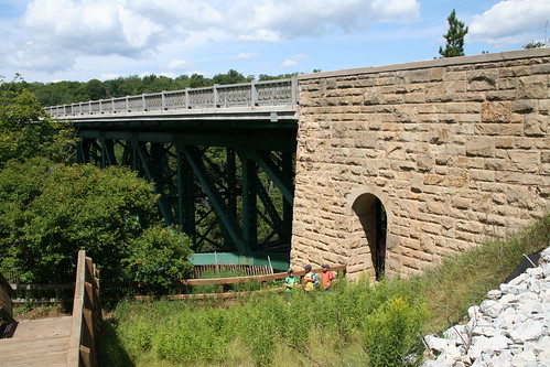
Cut River Bridge LbNA #5232
| Owner: | TJ_Mich
|
|---|---|
| Plant date: | Aug 8, 2003 |
| Location: | |
| City: | Epoufette |
| County: | Mackinac |
| State: | Michigan |
| Boxes: | 1 |
| Found by: | TJ_Mich |
|---|---|
| Last found: | Jul 30, 2024 |
| Status: | FFFFFFFFFFFFFFFFFFFO |
| Last edited: | Jun 19, 2021 |
Cut River Bridge is located in Michigan's Upper Peninsula along US-2 between the towns of Epoufette and Brevort. It's about 25 miles northwest of St. Ignace and the Straits of Mackinac.

You might pass over Michigan's 8th longest bridge and hardly even notice that it's there. The only indications are the roadside parks at either end, and the amazing view of Lake Michigan and the river valley as you drive across.
The locals call Cut River Bridge "the million dollar bridge over a two-bit creek." Cut River Bridge is a cantilevered steel deck bridge, built in 1946. It spans the tiny Cut River, a surprising 147 feet below. From either end of the bridge, you can descend a short ways and view the immense steel structure that supports the road.
On the east end of the bridge, there is a picnic area with outdoor facilities on the north side of the highway, and a smaller picnic and parking area on the south side of the highway. From the south side, a 231-step staircase descends all the way down to the Cut River and the beach along Lake Michigan. Here, you'll find 2 nature trails which run alongside the river and through the woods.
If you happen to park on the north side, there's no need to cross the highway. You can simply follow the sidewalk and boardwalk to cross underneath the bridge to reach the south side. This is a great place from which to view the bridge's structure.
From the east end of the bridge, take the 231-step staircase to the bottom. Then follow the East Trail, which winds along the Cut River. After passing underneath the bridge, watch on your right for a fallen birch along the edge of the trail. It lies in front of a group of fuzzy boulders. South of that, is another group of boulders. Look between that group of boulders to find what you seek. If you reach a steep washout on your right, you've gone too far along the East Trail.
Thanks to SpringChick for replacing the logbook for us in 2010 and again in 2016. We replaced the container in 2021 to keep this one dry inside.
See more box information at AtlasQuest.